A view of the Lachlan River in the town of Forbes, New South Wales, Australia, after a flood inundated the town, blocking roads and access routes and damaging crop yields of local farms.
Global climate change means not only a rise in average temperature, but also an increase in the rate of extreme weather events. In the Hawkesbury-Nepean Valley and other regions of New South Wales, Australia, this has likely exacerbated extreme flooding. In March 2021, flooding in the area led to the evacuation of 18,000 people and necessitated over 1,000 flood rescues by emergency services. These extreme weather events are only increasing in frequency and intensity, damaging property and disrupting infrastructure and supply lines for food and medicine in one of the most populous regions of Australia.
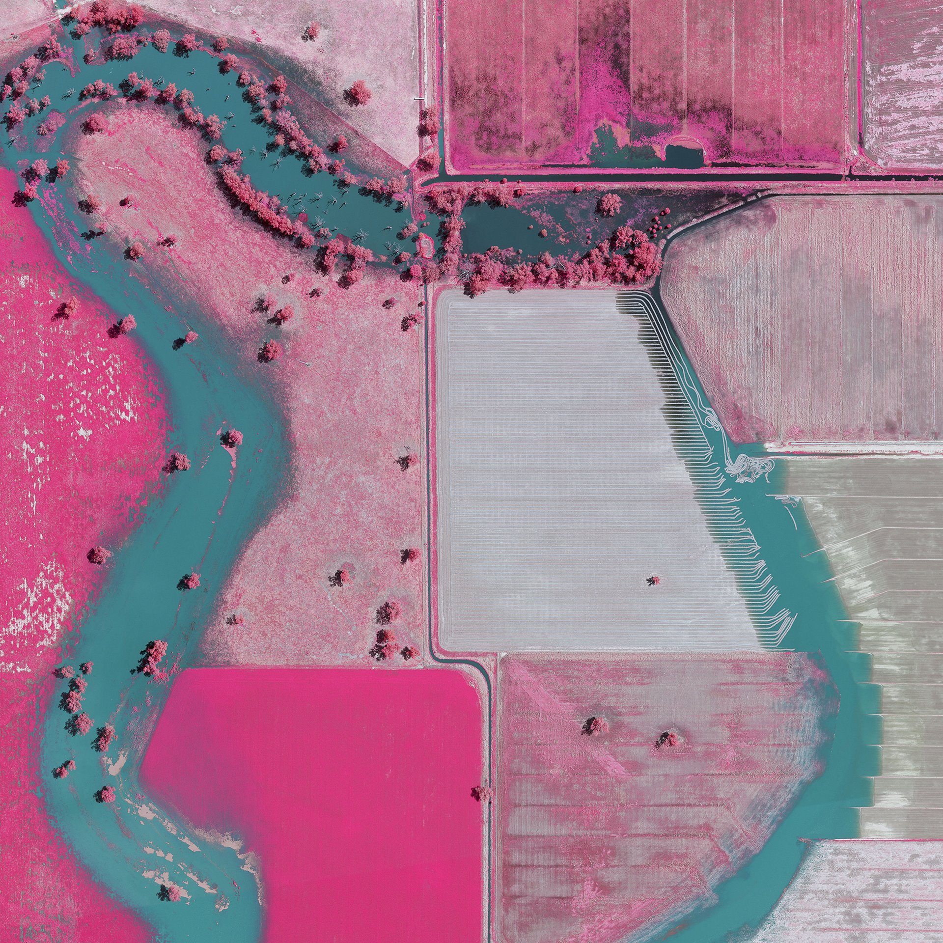
This series offers a unique perspective on the recent floods that have devastated New South Wales. Aerial infrared imaging renders vegetation in pinks and reds, contrasting sharply against blues and cyans, which represent water. These images make newly flooded areas easily discernible to post-disaster emergency responders, assisting with response and recovery. Beyond their utility to scientists, hydrologists and emergency responders, these images offer a visually striking perspective on the real time environmental and social impacts of the global climate crisis.
This project contains adaptations from raw data in NSW Flood Imagery Viewer by DCS Spatial Services, State of New South Wales, licenced under CC BY 4. Photographer Chad Ajamian works in emergency services in the area and has a deep connection to the affected communities. He has long been interested in infrared imaging technology and its ability to reveal the invisible.